


From preparation to presentation
Turnkey Solutions


Product information
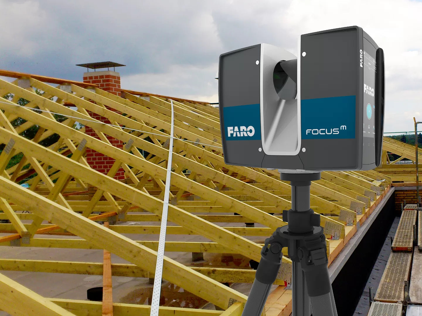
Step 1
Scanning & Point Cloud Registration
We capture millimetre-precise data using industry-leading FARO laser scanners, producing a highly accurate 3D digital representation of your site - without physical contact.
The scans are processed, cleaned, and aligned into a unified, geo-referenced point cloud that can be used directly or as the basis for further work. For some clients, this is the final deliverable, ready for reference, clash detection, measurements, or integration into their own workflows.

Step 2
3D Modeling & 2D Documentation
From the point cloud, we create precise 3D models and/or 2D drawings tailored to your industry and software requirements. These models allow your team to view and work with the project in 3D space, improving collaboration and communication.
Depending on your needs, we can deliver fully detailed BIM models, digital prototypes, or CAD drawings - ready for design, analysis, or fabrication.
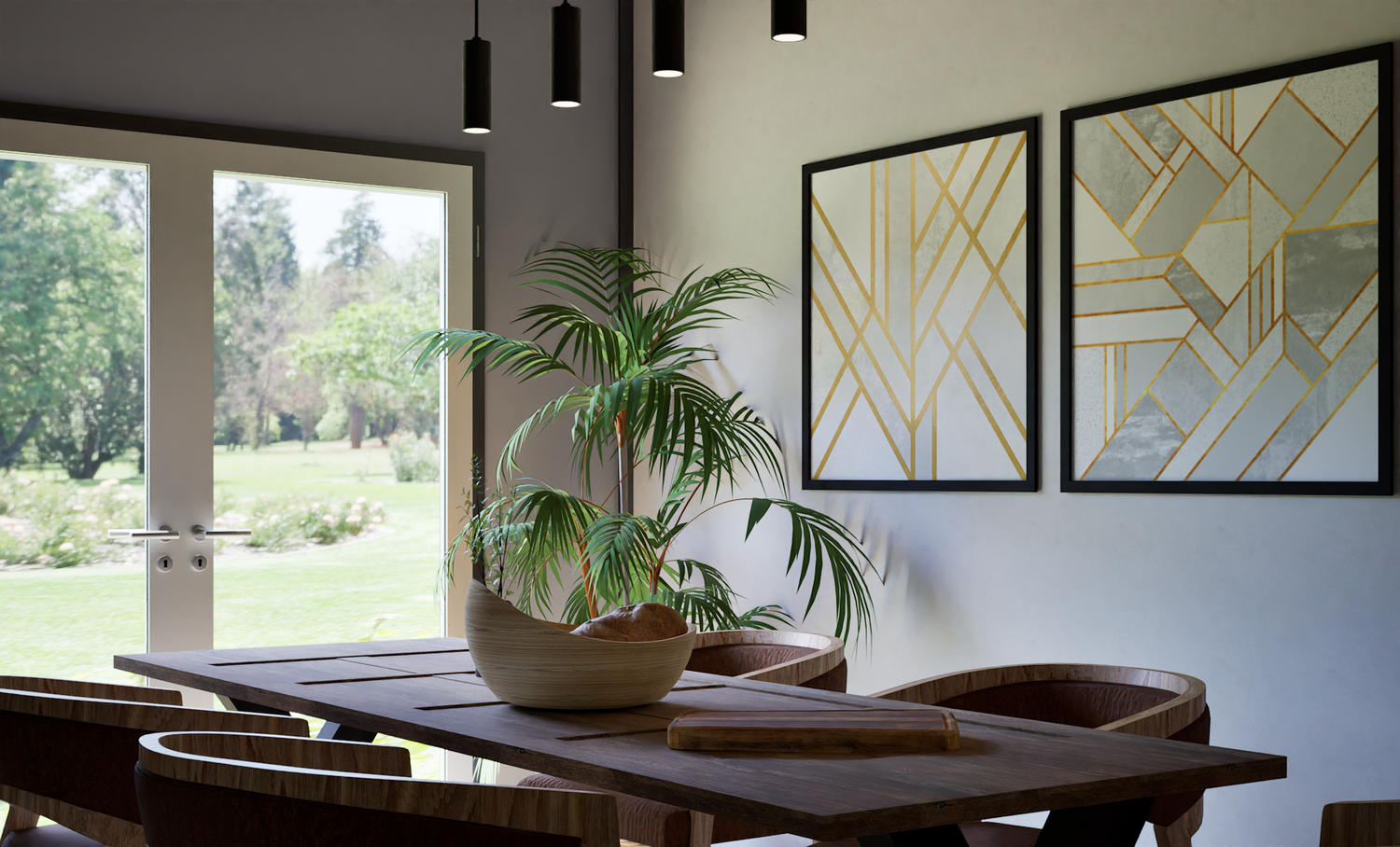
Step 3
Rendering and Visualisation
Once your 3D model or mesh is complete, we can transform it into compelling visuals for presentations, marketing, and stakeholder engagement.
Using state-of-the-art tools, we create photorealistic images, videos, panoramas, and even immersive virtual reality walkthroughs—bringing your project to life for clients and stakeholders.
Past Projects
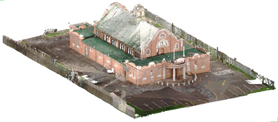
Maitland Town Hall
The customer was provided with a fully registered point cloud and detailed Revit model for documentation purposes.
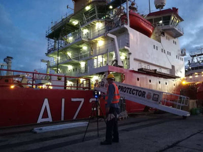
HMS Protector
Deliverable included fully registered point-cloud of the entire vessel.
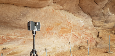
Elandsbaai Archaeological Site
Deliverable included fully registered point-cloud of the entire site, with high quality colour scans and HDR spherical photographs.
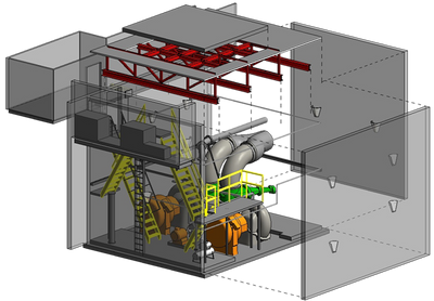
Pump-house
Laser scan to 3D model using Autodesk Revit and Inventor - done for the client for refurbishment purposes.
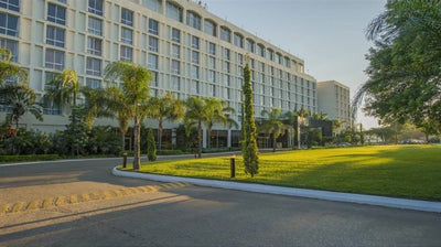
International Hotel, Lusaka - Zambia
18000 square meter project involving over 1600 scans with the deliverable as a highly detailed Revit model.
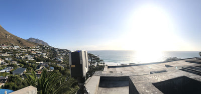
Llandudno Residence
We were commissioned to scan an upmarket Llandudno residence and then convert the highly accurate point-cloud into a fully fledged BIM model.
Maitland Town Hall
The customer was provided with a fully registered point cloud and detailed Revit model for documentation purposes.
HMS Protector
Deliverable included fully registered point-cloud of the entire vessel.
Elandsbaai Archaeological Site
Deliverable included fully registered point-cloud of the entire site, with high quality colour scans and HDR spherical photographs.
Pump-house
Laser scan to 3D model using Autodesk Revit and Inventor - done for the client for refurbishment purposes.
International Hotel, Lusaka - Zambia
18000 square meter project involving over 1600 scans with the deliverable as a highly detailed Revit model.
Llandudno Residence
We were commissioned to scan an upmarket Llandudno residence and then convert the highly accurate point-cloud into a fully fledged BIM model.
FAQ
How accurate is 3D laser scanning?
How accurate is 3D laser scanning?
Our FARO laser scanners capture millimetre-level accuracy, producing a point cloud that faithfully represents your site's real-world geometry. Final model tolerances are agreed with you upfront, based on whether you need documentation, fabrication or clash detection. Final accuracy depends on the level you choose, which in turn affects the project's duration and cost.
What level of detail can you model to?
What level of detail can you model to?
We model to whatever Level of Development (LOD) your project requires — from LOD 200 for early design and space planning, through LOD 350 for coordination and clash detection, up to LOD 400 where elements need to be fabrication-ready. We'll recommend the right level for your intended use, since modelling beyond what a project needs only adds time and cost without adding value.
What file formats do you deliver?
What file formats do you deliver?
Point clouds in E57, RCP, LAS, LAZ and other standard formats, and models in Revit, Inventor, AutoCAD or your preferred CAD/BIM package. We match every deliverable to your existing workflow so it drops straight into your team's software.
How long does a project take?
How long does a project take?
Turnaround depends on the size of the site and the level of detail you need. A single-building scan and registered point cloud can be ready within days, while a fully detailed BIM model takes longer. Because we can begin modelling as soon as the first areas are registered, we're often able to deliver in stages — and you'll get a firm timeline with every quote.
What areas do you cover?
What areas do you cover?
We're based in Cape Town and scan throughout South Africa, and we regularly take on projects further afield across Africa and beyond — past work includes an 18,000 m² hotel in Lusaka, Zambia. Travel and site logistics are factored into your quote.
Will scanning disrupt our site or operations?
Will scanning disrupt our site or operations?
Minimally. Laser scanning is completely non-contact, and our technicians work around your activities — so we can capture occupied buildings, live facilities and heritage sites without shutting them down. We coordinate access, timing and any safety requirements with you in advance.
Can you produce a Revit or BIM model from the scan?
Can you produce a Revit or BIM model from the scan?
Yes — scan-to-BIM is a core service. We convert your registered point cloud into an accurate, as-built Revit model at the LOD you need, ready for design, documentation, coordination or facility management.
How much does it cost?
How much does it cost?
Every project is quoted individually, based on site size, access, the scan density and accuracy required, and the deliverables you need. Send us your project details through the quote request form and we'll prepare a tailored estimate.
Ready to get started?
Click "Contact Us" to request more information, or "Request Quote" if you have a project in mind that you would like us to quote on.
Our team of experts look forward to streamlining your workflow and adding value every step of the way.